The natural conditions
Geographical location: Lao Cai province is mountainous border, halfway between the North East and North West of Vietnam, 296 km from Hanoi by the railway and 345 km by road. Natural Area: 6383.88 km2 (accounting for 2.44% of the country's largest province with an area of 19/64 provinces and cities nationwide).
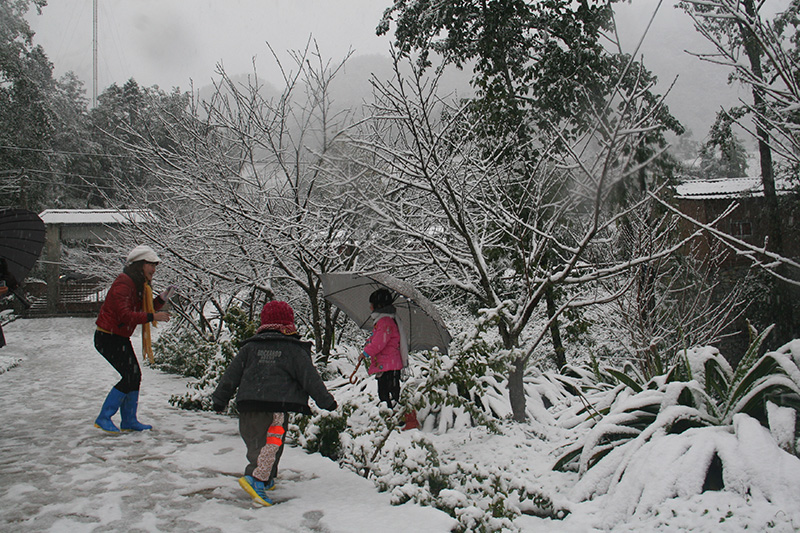 Sa Pa snow season.
Terrain: The terrain of Lao Cai is very complex, stratified high altitudes, dissected level max . The two main mountain range are Hoang Lien Son range and Con Voi in northwest - southeast located to the east and west to create the lowlands, averaging between two mountain ranges and an area west of the Hoang Lien Son. There are also many smaller mountain diversified distribution, divided to create cottage with different climate zones.
Due to the low altitude distribution quite clear, in that altitude from 300m - 1000m accounting for a large area of the province dissected terrain. The highest point is Fansipan moutain on the Hoang Lien Son at the high of 3,143 m above the sea level, Giang Ta Phinh is about : 3.090m.
Strip of land along the Red River and Chay River includes Lao Cai city - Cam Duong - Bao Thang - Bao Yen and Van Ban district of the eastern part of the lower elevations (the lowest point is 80m located in Bao Thang district) , dangerous terrain, valleys are favorable for agriculture and forestry production or construction, infrastructure development.
Climate: Lao Cai has a tropical monsoon climate, but because of the deep the continent divide is governed by complex topography, the weather change somewhat, differences in time and space. Mutations in temperature usually occur as the day temperature differences up too high or down low (Sa Pa region many days temperature is sometimes down below 00C and there is ice or snow). Climate Lao Cai divided into two seasons: the rainy season begins from April to October, the dry season starts from October to March the next year. The average temperature is located in the high from 150C - 200C (Sapa separate from 140C - 160C month and no more than 200C), average rainfall is 1,800 mm -> 2.000mm. The average temperature is located in low from 230C - 290C, the average rainfall from 1.400mm - 1.700mm.
Fog: Fog often commonly occurs across the province, to the extent where very thick. During the freezing period, in the high mountains airtight and valleys also appear hoarfrost, each phase lasting 2-3 days. Lao Cai climate is well suited to temperate crops, so Lao Cai has the advantage development of specialty cold countries where there are no other areas such as flowers, fruits, herbs and cold-water fish.
Pedology: Land with high fertile, diverse includes 10 group, 30 types of land, suitable for many different crops.
Editorial Board